Utah Storm Brings Snow, Snow, More Snow
Jan 21, 2019, 8:50 PM | Updated: 10:10 pm

SALT LAKE CITY, Utah – The biggest snowstorm of the season caused multiple challenges for first responders, road crews and others as they worked around the clock to clear roadways, restore power and keep the public out of harm’s way.
Monday’s winter weather event covered most of the Beehive State in a blanket of white, wet and slick snow.
Officials from the Utah Highway Patrol said they responded to over 200 crashes across the state. The numbers of injuries were not available, but there were no reported fatalities.
Troopers advised drivers to slow down on snow-packed and icy roads. Multiple law enforcement agencies advised Utahns to stay indoors unless they absolutely had to go out.
In Millard County, Interstate 15 was forced closed in both directions after an active power line fell across the roadway after a semi slide off. Traffic was directed for several hours into Kanosh as crews worked to repair the line.
There is an active power line across the road at MP 157 in I-15. A semi slid off in the area. Traffic is being diverted at MP 146 and 158 through Kanosh. Power company enroute. Hopefully it won't be too long. Both directions of I-15 are closed. Snowing heavily in the area.
— Utah Highway Patrol (@UTHighwayPatrol) January 21, 2019
Interstate 80 was also closed in Parley’s Canyon while plows cleared snow from the roads. It was several hours before drivers were allowed through the canyon.
Another semi rollover forced the closure of I-84 in Weber Canyon.
We are closing EB I-80 at Parley's Canyon until the snow can be better cleared. WB I-84 is still closed for a Semi-Rollover at the rest area in Weber Canyon (pic attached). We'll advise when each roadway re-opens. pic.twitter.com/JPESFttQbo
— Utah Highway Patrol (@UTHighwayPatrol) January 21, 2019
Both Big and Little Cottonwood Canyons were also closed while crews helped clear multiple slide-offs. Little Cottonwood was re-opened briefly before a natural avalanche forced it closed again.
Drivers who had left Snowbird and Alta ski areas were asked to turn around and go back to the resorts, where an interlodge was issued, meaning there were threats of other avalanches and severe weather.
The Town of Alta asked people to seek shelter inside one of the buildings at the resorts. They said violating the interlogde order carried a fine of $1,000 with possible jail time. Up to nine people were arrested over the last week for violating the order.
KSL meteorologist Kevin Eubank said Alta got 20 inches of snow.
Interlodge violations carry a potential $1000 fine and jail time. We're serious about this folks. LIVES CAN BE LOST. We have arrested nine individuals this week including today.
— Alta Central (@AltaCentral) January 22, 2019
Little Cottonwood Road was opened for a short time to let people leave, but the canyon remained closed to traffic driving up the mountain.
Officials said they anticipated re-opening the canyon Tuesday around 8 a.m., but would evaluate further overnight.
🛑 Little Cottonwood Canyon is closed. 🛑
Estimated reopening is 8:00 AM.
Straight line travel will be allowed between The Cliff Lodge, Snowbird Center, The Lodge at Snowbird, The Inn, and The Iron Blosam from 7:30 PM – 11:00 PM.
Interlodge protocol at 11:00 PM.
— Snowbird (@Snowbird) January 22, 2019
Jan21 Little Cottonwood 7:30pm Will remain closed overnight till 8AM Tuesday Jan. 22nd. Extreme avalanche danger. #utsnow
— UPD Canyon Alerts (@CanyonAlerts) January 22, 2019
In Summit County, Park City officials asked residents and visitors to avoid unnecessary travel through town, and to avoid coming to the area after getting 15-inches of snow.
Plows had a challenging time clearing snow from the narrow roadways due to the number of cars parked along the shoulders.
Drivers were asked to help by removing their vehicles from Main Street and Park Avenue so crews could clear the snow from the road overnight.
A parking lot has been provided at no charge where drivers can park through the night.
Crews will be working overnight through Wednesday night to remove snow from Main Street/lower Park Avenue. Overnight parking will be available in the Mahwhinney Lot, at no charge, through midnight Wednesday, 1/23. Please help out by removing your vehicle from the street. pic.twitter.com/b1qkC0T0xv
— Park City Municipal (@ParkCityGovt) January 22, 2019
In addition to clearing the streets of snow, the resort town has been preparing for the annual Sundance Film Festival, which begins on Thursday. The festival brings hundreds of people to the already busy town.
The winter weather also caused traffic problems in Southern Utah. State Route 9 through Zion National Park was closed Monday afternoon.
Travel on State Route 9 through Zion National Park is now closed to all vehicles due to winter road conditions. Travel on the Scenic Drive is still available but conditions are not good.
— Zion National Park (@ZionNPS) January 21, 2019
Who else ventured up to play in the snow today? pic.twitter.com/z4LdoLGVvA
— St George Police (@sgcitypubsafety) January 21, 2019
Although crews were able to clear most of the roadways by mid-afternoon, the snow just fell too quickly to keep on top of.
“It’s just coming down too fast, and it’s too hard to keep up with everything, so that’s the problem that we get,” said Thayne Tagge, a plow driver for a private company. “It doesn’t happen all the time. There have been a few storms like this. This has been one of the worst I’ve seen.”
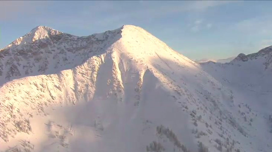
Aerial video of the snowpack on Friday, January 18, 2019. (Chopper 5)
The snow also caused problems at Salt Lake International Airport. Officials there told KSL they had delays all morning and into the afternoon.
They said 100 flights were delayed – 46 incoming and 54 outgoing. Delays were anywhere from 30 minutes to two hours. Three Southwest Airlines flights were canceled.
Officials advised checking the status of your flight before heading to the airport.
Nearly 14,000 customers were without power Monday morning, according to Rocky Mountain Power. By 9 p.m., that number was down to just over 1,500 customers.
Eubank said the Salt Lake Valley only got 4-inches of snow, but the benches picked up anywhere from 6 to 12 inches.
Most of the storm clouds had dissipated by late afternoon, but Tooele and parts of Summit County were still getting snowfall, as were central and southern Utah.
As the storm comes to and end and clearer skies take over, temperatures were expected to quickly drop.
At 6 p.m., the temperature in Salt Lake City was 32 degrees. The overnight temperature was expected to drop below 20 degrees, meaning all the wet, slushy snow from Monday would freeze, causing icy conditions for Tuesday morning commuters.
Drivers have been advised to avoid travel early in the morning, or to give themselves plenty of extra time and drive slowly.
The next winter weather was expected to clip Northern Utah Wednesday from Bear Lake to the Wasatch and Uinta Mountains.
It was expected to bring a couple more inches to the mountains, but not much more than cloud cover to the valleys.
Despite the traffic challenges, the snow was good for the state, improving the snowpack in several key areas.