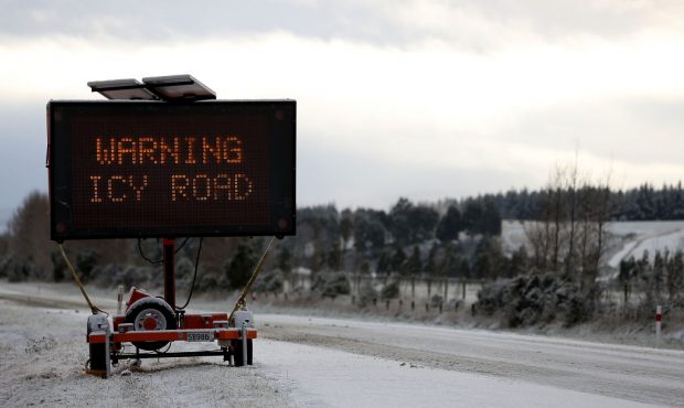
Snow, Ice On Multiple Roads In Utah On Monday
Nov 9, 2020, 4:40 AM | Updated: 8:04 am
FILE (Photo by Dianne Manson/Getty Images)
(Photo by Dianne Manson/Getty Images)

SALT LAKE CITY, Utah – Sunday’s storm took a break overnight, but authorities said the snow could pick up again as Utahns begin their drive to work Monday.
The National Weather Service issued a winter weather advisory that lasts until 11 a.m., and it forecasted another round of snow falling in areas of the Salt Lake and Tooele valleys just in time for the morning commute.
Crashes Reported Across The State
UDOT reported multiple crashes across the state within about 15 minutes.
- Northbound I-15 at mile post 170 near Fillmore – northbound lanes are blocked
- Northbound I-15 at mile post 225 near 100 South in Nephi
- Eastbound I-70 at mile post 141 about 19 miles west of Green River
- SR-10 at mile post 42 about 4 miles north of Castle Dale
- US 89 at mile post 245 about 3 miles northeast of Gunnison
UDOT Reminds Drivers That Chains/4-Wheel Drive Required In Areas
Traction laws are still in effect for both Cottonwood Canyons.
“Road conditions are wet in lower, snowpack and icy in areas in upper,” according to UDOT’s Cottonwood Canyons Twitter. “Additional 2-4 (inches) is expected for upper canyon, snow to taper by early PM”
#RoadUpdate G‘ morning #CottonwoodCanyon travelers. Road conditions are wet in lower, snowpack and icy in areas in upper. The #TractionLaw is still in effect.🚨Additional 2-4" is expected for upper canyon, snow to taper by early PM. #SR210 #LCCroad #SR190 #BCCroad pic.twitter.com/bkNM8yDjPd
— UDOT Cottonwood Canyons (@UDOTcottonwoods) November 9, 2020
Signal Problems in Lehi, Crash At I-15 Onramp in Provo
The Utah Department of Health reported two more incidents Monday, both in Utah County.
Signal problems
All Directions Redwood Rd at 2600 N, Lehi Utah Co,
TREAT AS A 4 WAY STOP,
Est. Clearance Time: 7:10 AM
For updates: https://t.co/jaVMw7vcLm— UDOT Traffic (@UDOTTRAFFIC) November 9, 2020
Crash
SB I-15 at University Ave On ramp (Provo) Utah Co.
Right Shoulder
Est. Clearance Time: 7:30 AM
For updates: https://t.co/jaVMw7vcLm— UDOT Traffic (@UDOTTRAFFIC) November 9, 2020
UDOT Reports 3 Crashes On I-80 In Salt Lake County
The Utah Department of Transportation reported three crashes, one of which forced the closure of an onramp.
According to UDOT, the ramp from northbound I-215 West to eastbound I-80 is closed due to a crash. Commuters should use an alternate route.
The other two crashes – one at westbound I-80 at Terminal Ramp at the Salt Lake City airport, and one on southbound I-215 West at the I-80 junction – have lanes cllosed.
Between One-Half – 6 Inches More Snow Expected Across Utah
KSL weather specialist Grant Weyman said more snow is expected Monday, and some of the southern mountain areas could see between 4 – 6 inches.
“The Wasatch Front will see more clearing this afternoon, but it stays cold,” according to Weyman. “Under 40 today and tomorrow, with more snow showers possible Tuesday.”
Here's a look at how much MORE snow we will see today pic.twitter.com/ooKlK8XRkb
— Grant Weyman (@KSLweyman) November 9, 2020
Utah Dept. of Transportation Issues Road Weather Alert
UDOT issued a road weather alert for multiple highways in Utah.
“Snow showers are expected to pick back up early Monday morning and continue till the noon hour primarily affecting Weber, Davis, Salt Lake, and Tooele Counties,” according to the department. Light road snow is expected during this time, potentially impacting the morning commute.”
Roads along the Wasatch Back are also expected to see scattered snow showers through Monday afternoon.
Some @UtahDOT snowplows in Parley’s Canyon this morning. Photographer Tanner Siegworth and I are on the @KSL5TV morning team today! We’re watching the morning commute with the expected snow coming. #ksltv #kslam #tired @DanSpindleKSL @haleysmithKSL @LoriPrichard @KSLSharaPark pic.twitter.com/aKvpJE071r
— Alex Cabrero (@KSL_AlexCabrero) November 9, 2020
In Southern Utah, UDOT warned that snow showers are expected at times through the morning, and light road snow is expected on all mountain routes and the summits along I-15.
“Motorists heading up canyon and mountain routes should be prepared for chain restrictions at any time during snow events,” according to UDOT.
The department noted the following routes will experience weather-related travel concerns Monday morning:
- I-15, Ogden to Point of the Mountain; Scipio Summit; Cove Fort to Beaver Ridge
- I-84, I-15 Jct. to I-80 Jct.
- I-80, Dugway exit to WY/UT border
- I-70, I-15 Jct. to Fremont Jct.
- US-40, Silver Creek Jct. to UT/CO border
- US-89, Logan Summit; I-84 Jct. to Farmington; US-6 Jct. to Fairview; Sevier to Mt. Carmel Jct.
- US-191, WY/UT border through Indian Canyon Summit; La Sal Jct. to Blanding
- US-6, Skull Rock Pass; US-89 Jct. to Helper
- SR-12, Entire route
- SR-14, Entire route
- SR-20, Entire route
- SR-31, Entire route
- SR-153, Entire route
- SR-143, Entire route
- SR-150, Entire route
- SR-190 Big Cottonwood Canyon
- SR-210 Little Cottonwood Canyon
- SR-189 Provo Canyon
The Utah Department of Transportation is also requiring chains or 4-wheel drive for all vehicles on state Routes 190 and 210 through Big and Little Cottonwood canyons.
What to Expect Today
According to the National Weather Service, northern Utah will see snow pick up again Monday morning and then taper off during the afternoon.
In Southern Utah, the storm is expected to taper off Monday morning.
“The snow will cause travel difficulties across mountain routes,” according to NWS. “Areas south and southeast of the Great Salt Lake could see travel impacts during the Monday morning commute.”
Snow will continue to impact the area into tomorrow. Here's what you can expect with regard to timing, impacts, and additional accumulations. For your detailed local forecast, visit https://t.co/FmlUW3ioiE. #utwx pic.twitter.com/OflxW9V3dz
— NWS Salt Lake City (@NWSSaltLakeCity) November 8, 2020