Winter storm watch goes into effect for Utah Wednesday night
Dec 8, 2021, 10:25 AM | Updated: 10:31 am
(National Weather Service Salt Lake City)
(National Weather Service Salt Lake City)
SALT LAKE CITY — A large portion of Utah will be under a winter storm watch Wednesday night as an impactful weather system moves into the area.
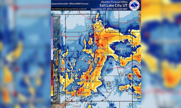
KSL meteorologist Grant Weyman said the system will arrive early Thursday, producing widespread snow that lasts into Friday. The Salt Lake Valley will receive its first measurable snow of the year while northern and southern Utah mountains will see 1′ to 2′ of snow.
Salt Lake City could see 4″ to 6″ of snow, with Provo and Ogden expected to get around 3″ of snow. Park City could see up to 12″ of snow with this storm.
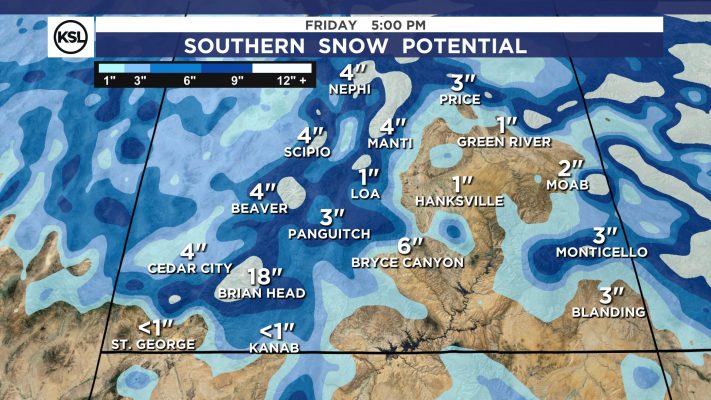
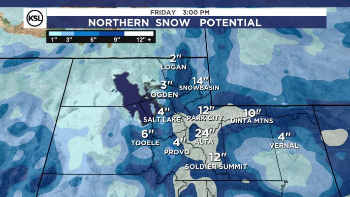
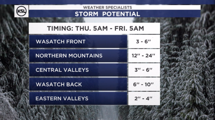
Meteorologists say heavier snowfall is possible in northern Utah during Thursday’s morning commute while heavier snow is expected in central and southern Utah later in the day.
“Travelers during the Thursday morning commute should drive slow on area highways and roadways and remember their skills in driving in winter conditions,” officials with the National Weather Service said. “Leave extra space between you and the vehicle in front of you.”
Here's what it should look like tomorrow at 5am. Rain mixing with snow for the Wasatch Front- and snow sticking in the higher elevations. pic.twitter.com/5BQ25dBfpK
— Grant Weyman (@KSLweyman) December 8, 2021
Much-needed moisture
The National Oceanic and Atmospheric Administration released its State of Climate Report for November, which showed last month was the second-warmest November on record for Utah.
Utah saw below-average precipitation for the month, while parts of the Beehive State received just 5% of the average precipitation for November.
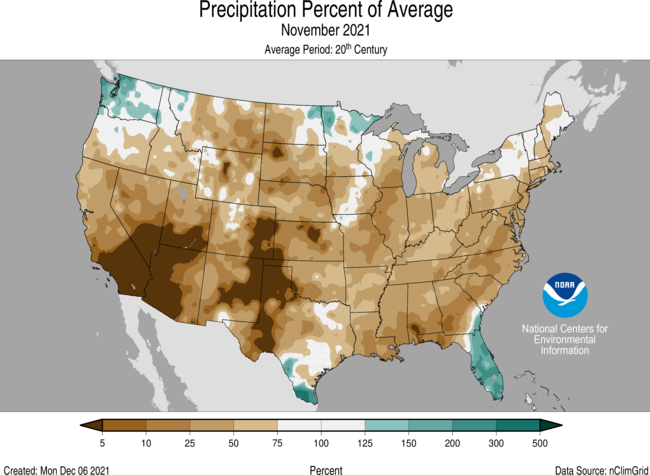
(NOAA)
Just under 10% of Utah is seeing exceptional drought — the highest level of concern issued by the U.S. Drought Monitor — but that number is down from 24.46% at the end of August.
Just under 80% of the state remains in extreme drought conditions. One year ago, 90% of Utah was experiencing extreme drought conditions.