Utah braces for another round of snow
Jan 4, 2023, 4:30 PM | Updated: 5:26 pm
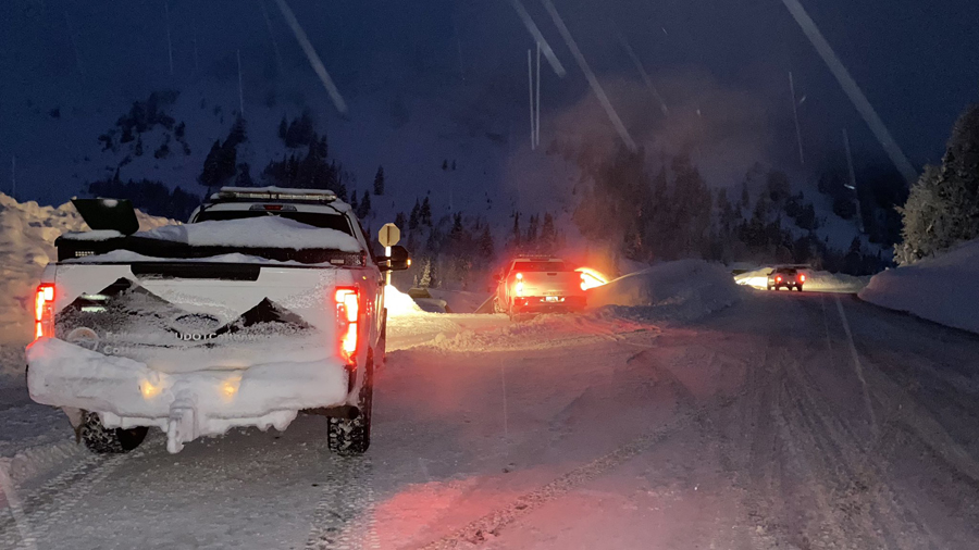
UDOT closed Little Cottonwood Canyon for avalanche mitigation, Jan. 2, 2023. (KSL TV)
(KSL TV)

SALT LAKE CITY — The National Weather Service issued a winter storm watch for Utah’s southern mountains that will take effect Thursday as another storm moves in.
The watch calls for six to 12 inches in the southern mountains.
Snow has already been plentiful in mountain areas, with heavy snow contributing to an ongoing power outage at Sundance Mountain Resort and surrounding homes. Rockey Mountain Power did not expect to have power completely restored until Friday.
KSL TV meteorologist Kirsten Van Dyke said the new storm will move into the St. George area Thursday.”We might see some rain there earlier in the afternoon. But by 3 p.m. along the Wasatch Front, we will start to see those first few sprinkles of rain.”
This latest storm will come from the ‘bomb cyclone’ that is is hitting the California coast. The National Weather Service in the Bay Area warned residents that the “truly brutal” system needs to be taken seriously.
The system could trigger “immediate disruption to commerce, and the worst of all, likely loss of human life,” forecasters say. It comes on the heels of a round of record-breaking rainfall that slammed the same area over the weekend.
⚠️🧵 Early morning weather update
❄A Winter Storm Watch is now in effect for Thursday evening into Friday morning for the southern mtns. 6-12 inches expected, with up to 15 inches Pine Valleys and Brian Head area. Definite potential for more…something to monitor. #utwx
— NWS Salt Lake City (@NWSSaltLakeCity) January 4, 2023
In Utah, the rain turns to snow Thursday night and could make for an iffy commute Friday morning.
The Wasatch Front can get up to four inches of snow. Van Dyke said it could be more depending on when the rain changes into snow.
Right now, for the Wasatch Front and other northern valleys, expect the change from rain to snow to be Thursday night into Friday morning. Current forecast is T-2" valley floors, locally up to 4 inches benches by Friday afternoon. #utwx
— NWS Salt Lake City (@NWSSaltLakeCity) January 4, 2023
“Friday afternoon, most of this is cleared out, and then we’ll get some dry time this weekend before another storm moves in,” Van Dyke said.
Snowplow drivers in the Cottonwood Canyons can use the break. Over the past three-and-a-half weeks, the plow operators who worked the canyons had one day off, thanks to a break from the snow on Christmas.
“So yeah, it’s been super busy,” said Shawn Wright, Utah Department of Transportation Cottonwood station supervisor. “A pretty big challenge for us, trying to get through traffic, getting the roads plowed out.”
He said it’s been especially challenging as roads closed for avalanche mitigation, including a major one last weekend.
“That’s pushed hundreds and hundreds of more cars through Big Cottonwood,” Wright explained.