Another winter storm warning issued as more snow arrives in Utah
Dec 7, 2023, 5:30 PM
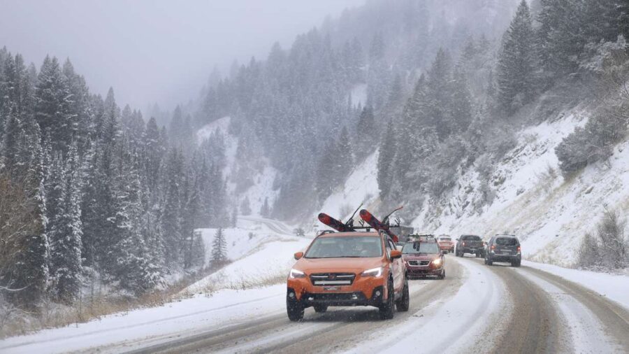
Motorists drive in Big Cottonwood Canyon on Dec. 1. The upper Cottonwood canyons could receive up to another 2 feet of snow from a storm arriving late Thursday and early Friday morning, federal forecasters say. (Laura Seitz, Deseret News)
(Laura Seitz, Deseret News)

SALT LAKE CITY — Winter storms are beginning to line up in Utah’s mountains, after a relatively slow start to the snow collection season.
Some snow returned to the mountains as a cold front passed through Thursday morning, but that was “just an hors d’oeuvre” and the main course is set to arrive in waves throughout Friday, says KSL meteorologist Matt Johnson.
The National Weather Service issued a winter storm warning for the Wasatch Mountains ahead of the stronger snowfall expected. The incoming storm isn’t forecast to be as strong as the atmospheric river that pelted northern and central Utah with as much as 4 feet of snow this past weekend, but it is still forecast to deliver quite a punch in a shorter period.
Eight to 18 inches of snow are forecast across the range by the end of Friday, while areas like the upper Cottonwood canyons — which collected the most in the last storm — could receive up to another 2 feet of snow.
Federal forecasters also issued multiple winter weather advisories for other parts of the state, which will last through most of Friday. These state another 6 to 12 inches of snow are forecast for the mountains across central Utah, while 2 to 6 inches are forecast for the Wasatch Backcountry, including Heber City, Huntsville and Park City.
NEW: We’ve issued Winter Storm Warnings & Winter Weather Advisories for the mountains and mountain valleys of northern Utah ahead of Friday’s storm system. The snow will bring some travel issues for the morning commute. Here’s what you can expect, including snowfall totals. #utwx pic.twitter.com/A3V6E4l0ro
— NWS Salt Lake City (@NWSSaltLakeCity) December 7, 2023
Johnson says Utah’s southern mountains may receive up to 6 inches of snow. Meanwhile, anywhere from a trace to 3 inches is possible across the valleys in northern and central Utah. Bench areas could end up with 1 to 4 inches of snow.
He explains a low-pressure system northeast of Utah helped push in the cold front. Another low-pressure system in the Pacific Northwest will move into Utah between late Thursday and early Friday, bringing more widespread snow to the mountains early Friday morning.
This means a possibly slick Friday morning commute.
Road Weather Alert
Friday Cold Front Throughout Northern Utah
Road snow expected late tonight through Friday night. For details, visit: https://t.co/AyNspjkXhL#utsnow #utwx @UtahTrucking pic.twitter.com/BEbCzf9TJr— UDOT Traffic (@UDOTTRAFFIC) December 7, 2023
“Light road snow is expected across most of the Wasatch Front before and during the Friday morning commute,” the Utah Department of Transportation advises. “Periods of moderate to heavy road snow are expected late tonight with the threat gradually decreasing throughout Friday afternoon.”
Drivers should “use caution” while traveling through mountain passes throughout most of Friday, the agency said. Blowing wind may significantly reduce visibility at times along the mountain passes, according to the weather service.
Precipitation will be persistent in the mountains but become more scattered in the valleys as the day continues, Johnson said. It’s expected to begin to taper off Friday evening. All of the weather service’s alerts expire at 11 p.m. Friday.
Clearer conditions are forecast for this weekend. Full seven-day forecasts for areas across Utah can be found online, at the KSL Weather Center.