Warning issued for parts of Utah ahead of ‘significant’ late season winter storm
May 4, 2024, 2:31 PM

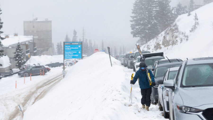
Will Malizia walks up the road to his truck after a day of skiing Snowbird Ski Resort is seen in Little Cottonwood Canyon on Monday, March 4, 2024. After a weekend of snowstorms, the snowpack depth is currently at 107 inches. (Marielle Scott, Deseret News)
(Marielle Scott, Deseret News)
SALT LAKE CITY — Winter is not over yet in Utah’s mountains.
The National Weather Service issued a winter storm warning for the Wasatch and western Uinta mountains ahead of a “significant late season storm” that could dump as much as 1 to 2 feet in parts of the region between Sunday and Tuesday.
“Significant mountain snow across northern Utah is expected through this time, with the heaviest period anticipated on Sunday,” the agency wrote on social media platform X.
KSL meteorologist Kevin Eubank said some valley communities in northern Utah could also receive over an inch of rain by Monday night.
Storm timing
The storm is expected to follow a much smaller system that delivered a few inches of mountain snow Friday morning. It was dumping moisture into parts of the Oregon and Washington coasts Friday afternoon, but it’s forecast to move southeast, arriving in Utah by Sunday morning, Eubank said.
But strong winds will impact communities first. The National Weather Service issued high wind warnings and wind advisories for most of western Utah, where wind gusts of up to 55 to 60 mph are forecast between Saturday afternoon and the first half of Sunday.
That could result in some damage, including downed trees and powerlines.
The winds are projected to calm down as a cold front moves through the state. The storm will bring a mix of rain and thunderstorms in the valleys, while snow will fall in the mountains.
“It’s got cold air, it’s got abundant moisture and it’s really going to hit northern Utah extra hard,” Eubank said. “It rains all day Sunday and lingers into Monday. … And then, even into Tuesday, we’re dealing with rain.”
Eubank adds there a chance some of the rain will turn to snow at bench levels on Monday, but it may not result in much accumulation. The system is forecast to clear out by Tuesday.
High temperatures along the Wasatch Front are forecast to drop from the upper 70s on Saturday to low-to-mid 50s by the start of next week. Highs near St. George will also slide from the mid-80s to upper 60s and lower 70s but are forecast to return to the upper 70s by Tuesday.
Storm accumulations
About 8 to 16 inches of snow is forecast for most of the areas within the storm warning, but the weather service notes that up to 2 feet of snow is possible in upper parts of the Cottonwood canyons and the mountains near Ogden.
“Winter driving conditions are expected, especially above 7,500 feet,” the warning states. “Those in the backcountry will experience winter-like conditions.”
Much lower snow totals are forecast for the central and southern mountain ranges.
Eubank said most moisture is expected to end up near Nephi and areas north. KSL Weather models updated on Friday show it has the potential to deliver about 1 to 1.25 inches of rain between Provo and Logan with higher totals in the bench areas.
The same model suggests that up to a half-inch is possible in central Utah, while parts of southern Utah could receive up to a tenth of an inch of precipitation. All of the numbers could change as the storm arrives.
Storm impact
The incoming storm comes as Utah’s above-normal snowpack continues to melt. While a storm last week put Weber County officials on alert for flooding concerns, the National Weather Service is more optimistic that this weekend’s storm won’t be as problematic because of its dynamics.
Sam Webber, a meteorologist for the National Weather Service, said it appears that it will be cold enough to avoid rain falling on snow, which speeds up the snowmelt process and causes flooding. That’s because most of the remaining snow is in the high elevations.
“There’s no concern for flooding right now,” he said. “We’ll keep track of it. We’ll see some rises on some of the creeks and streams — kind of the natural response to an increase in water — but it appears it will be within the capacity of the drainages.”
Utah’s average mountain snowpack is down to 8.8 inches of snow water equivalent, a little less than half of the peak of 18.8 inches on April 2.
Full seven-day forecasts for areas across Utah can be found online, at the KSL Weather Center.


