Spring storm brings heavy snow to mountain areas, with more expected Tuesday
May 7, 2024, 11:06 AM | Updated: 12:58 pm

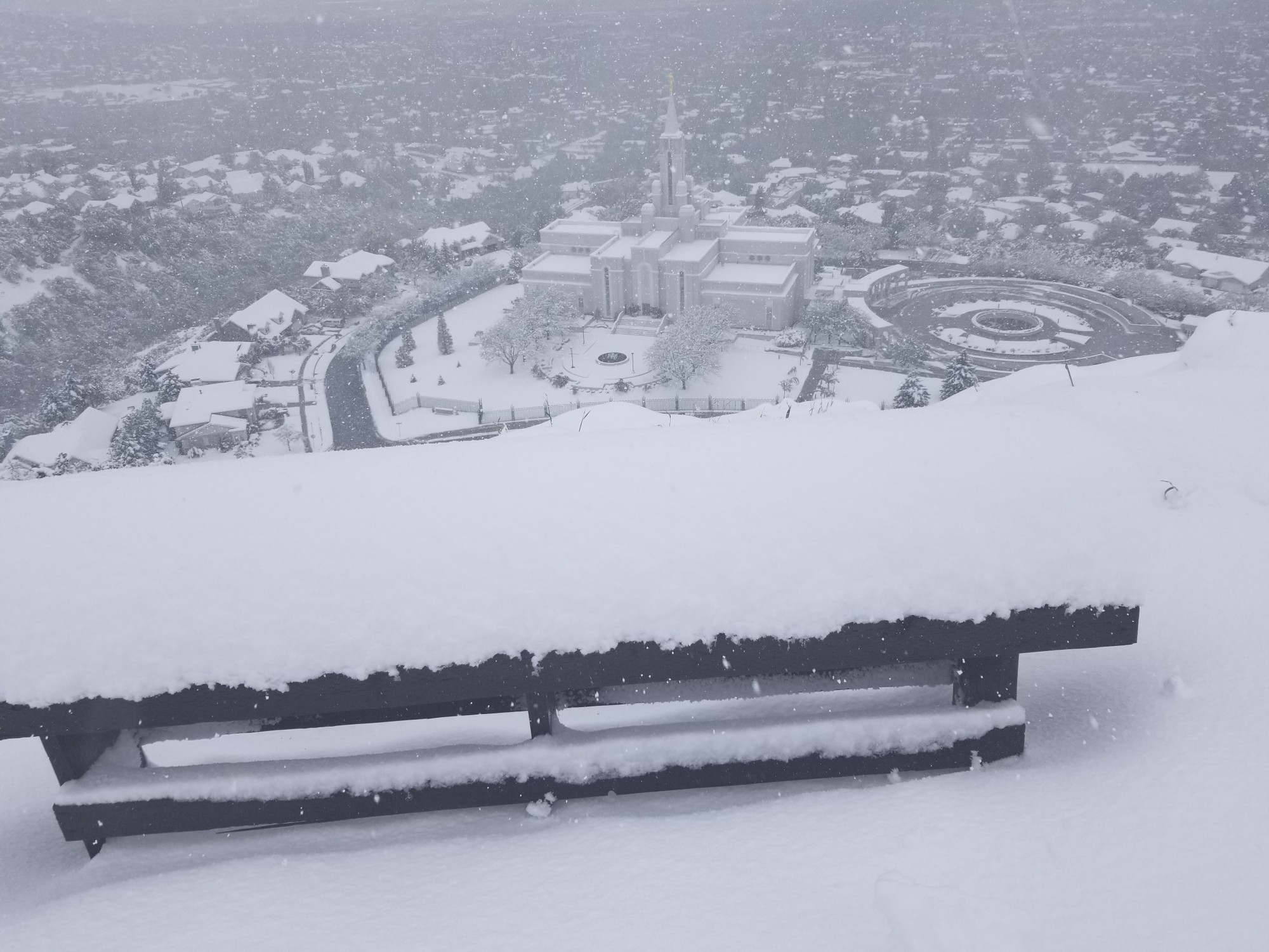
From just above the Bountiful Temple, taken at 10 am Monday. Two feet of snow. Thousands of broken and bent trees. (Viewer submitted)
(Viewer submitted)
SALT LAKE CITY — A cold front brought spring snow of up to two feet in some mountain areas and up to 8-10 inches in some places across the Wasatch Front and more is expected Tuesday. The National Weather Service issued a freeze warning and winter storm warning on Tuesday for multiple areas along the Wasatch Front.
The late season snow storm from over the weekend into Tuesday is not the latest snow to hit valleys in Utah history.
As recently as 2017, Utah valleys got snow on May 17 and 18. In 2010, it snowed in Utah on May 24, and the latest snow recorded in Utah was on June 6, 1914.
Was Sunday’s valley snow record breaking? No, but definitely late. Here’s a list of the top latest measurable snowfalls in SLC history:
June 6, 1914
May 24, 2010
May 20, 1908
May 18, 1902, ‘60, ‘71, ‘77, ‘17
May 17, 1971, ‘17
May 15, 1955
May 11, 1967, ‘83, ‘00— Matthew Johnson (@KSL_Matt) May 6, 2024
Multiple people took to social media sharing their disappointment or surprise over the late snow storm.
Who ordered giant snow flakes in May? #utwx #utah pic.twitter.com/l1Z7Dlj9uF
— Heidi Whitaker (@HeidiWhitaker) May 5, 2024
Utah 😭😭😭 #snow pic.twitter.com/8h0iZ6QkDo
— Just jacacita (@JACELANCASTER4) May 6, 2024
Does Utah have the BEST or the WORST spring weather?!?🌷🌧️❄️
Shorts and sunny yesterday and hoodies and snow today! Then of course tomorrow is gonna be a POWDER DAY! 👏🏽🏂
I love this place!! #utah #utwx #sunny #snowing #weather #spring #powderday #beUtahful pic.twitter.com/hni2p9mA23
— Zahm (@justzahm) May 5, 2024
Others headed up to the ski resorts to take advantage of the fresh powder.
14 INCHES OVERNIGHT 🥹❄️ This is the middle of our boardercross right now. These spring conditions are not what we were expecting, but we aren’t complaining 🌨️ pic.twitter.com/Q28NLa0RVU
— Brighton Resort (@BrightonResort) May 6, 2024
The storm was one of the biggest of the season, totaling 25 inches at Alta, 21 inches at Snowbird, 16 inches at Solitude, and 14 inches at Brighton — and there could be more to come.
Storm total: 24 inches and counting 📈 pic.twitter.com/AbZHUWTpfe
— Alta Ski Area (@AltaSkiArea) May 6, 2024
One of the biggest storms of the season is here, bringing with it a lot of everything: SO much snow, wind, stoke, hard work from our teams & patience from our guests. As we look to break the 600” mark for season-to-date snowfall overnight, it feels more like February than May🤘 pic.twitter.com/TVrY0AKfa1
— Snowbird (@Snowbird) May 6, 2024
The National Weather Service for Salt Lake City issued freeze warnings and winter storm warnings for different parts of the state on Tuesday.
A storm warning is in effect until midnight on Wednesday for the Wasatch Mountains including Interstate 80, North-Wasatch Mountains south of I-80 and the Western Uinta Mountains including the cities of Mantua, Logan Summit, Alta, Brighton, Mirror Lake Highway, and Moon Lake.
Heavy snow is expected with accumulations of four – eight inches and up to 12 inches in the upper Cottonwood Canyons and high Uintas.
The weather service advised people to check road conditions and avoid driving in those areas if possible.
“If you must travel, keep an extra flashlight, food, and water in your vehicle in case of an emergency,” the advisory stated.
The National Weather Service also put out a freeze warning for Eastern Box Elder County, Tooele/Rush Valleys, Utah Valley, and the San Rafael Swell through Wednesday morning.
Morning temperatures are looking very chilly, especially for your Wednesday morning. Freezing or sub freezing temperatures are forecast for several northern Utah valleys. Make your necessary protections for outdoor plants and agriculture. #UTwx pic.twitter.com/B0NFEenqPd
— NWS Salt Lake City (@NWSSaltLakeCity) May 6, 2024


