Winter storm watches, warnings issued as snow continues this weekend
Jan 6, 2024, 10:18 AM
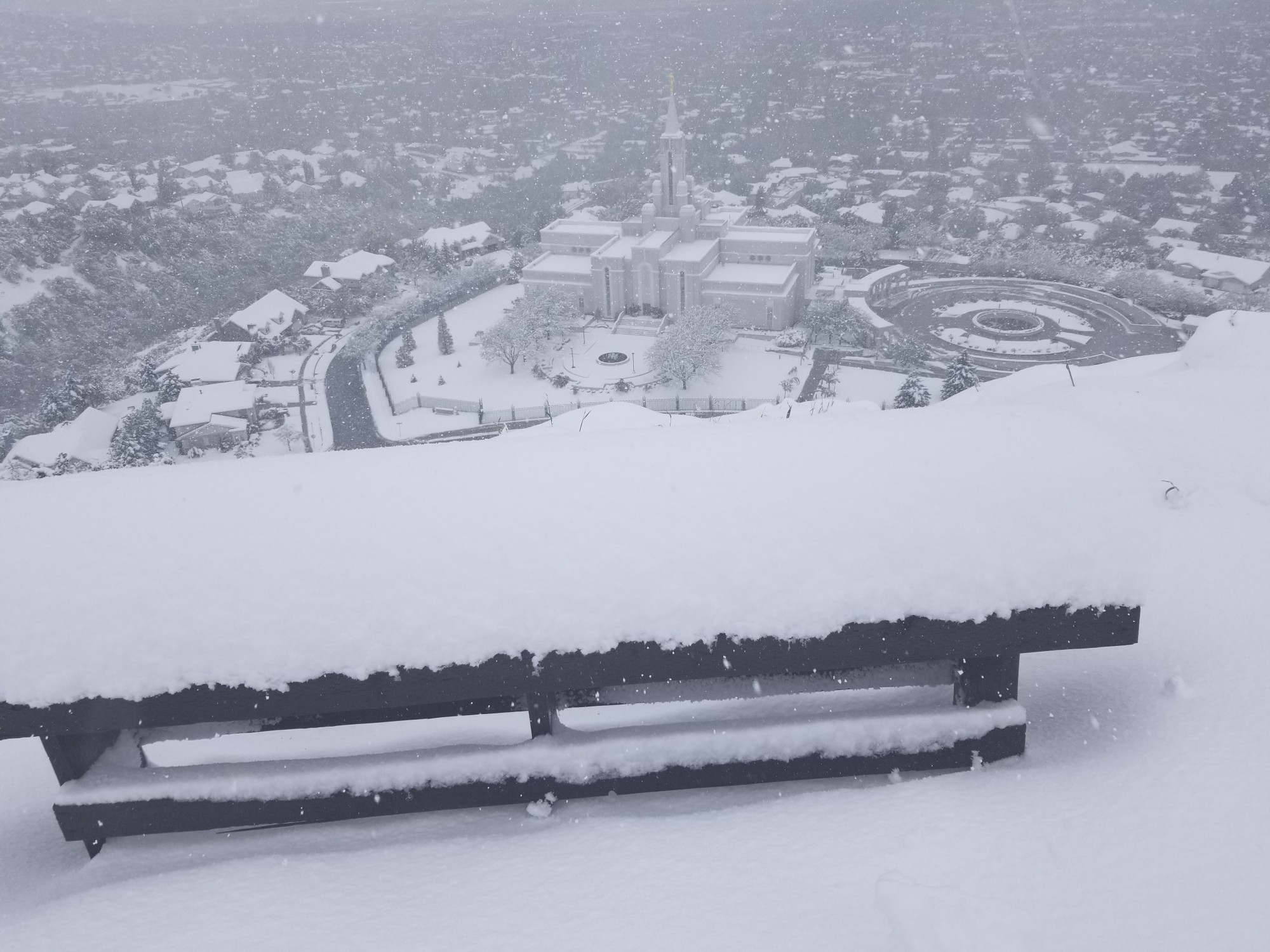
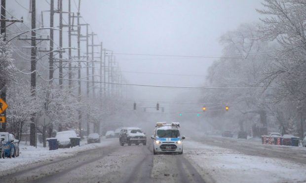
A snowplow clears the road in Big Cottonwood Canyon on Dec. 1. A third storm is expected to impact Utah this weekend, providing more snow in the valleys and mountains. (Laura Seitz, Deseret News)
(Laura Seitz, Deseret News)

SALT LAKE CITY — More snow is headed Utah’s way after the slow start to the season.
The National Weather Service’s Salt Lake City and Grand Junction offices issued a series of winter storm warnings, watches and winter weather advisories throughout Utah ahead of yet another storm headed to the Beehive State this weekend.
It’s set to arrive on the heels of two other storms that have impacted the state since Wednesday, adding over a foot of snow in some mountain areas and a few more inches to the valleys along the Wasatch Front to what has already fallen thus far.
“This isn’t just a Wasatch Front storm, we’re talking about a lot of locations (in) west and eastern Utah — with this second wave — that’ll pick up snow,” said KSL meteorologist Matt Johnson.
Storm timing and accumulations
Brian Head Resort in southern Utah is the snow accumulation leader from the storms that returned to Utah this week, receiving 18 inches of new snow between Wednesday and Saturday morning. Alta and Snowbird resorts also received more than a foot of snow in recent days.
The next low-pressure system is coming off the Pacific Coast in Canada and is forecast to arrive in Utah via Nevada, producing snow beginning Saturday night. Showers are expected to continue into Sunday morning with some hit-and-miss snow showers Sunday afternoon.
“Then we start to see things die down into Sunday night,” he said.
A winter storm warning was issued for a corner of southeast Utah, which will be in effect from 11 p.m. Saturday to 5 a.m. Monday. It states that 6 to 18 inches of snow is forecast for the La Sal and Abajo Mountains during that time, while lower elevations parts of the region are forecast to receive 4 to 8 inches of snow along with wind gusts of up to 45 mph, which may “significantly reduce visibility” at times, the warning states.
Areas that are forecast to receive snow first remain in either a winter storm watch or winter weather advisory for now. The winter storm watch, which begins Saturday evening and lingers through most of Sunday, covers mountain and valley areas across most of the state. The alerts anticipate:
- 10 to 18 inches of snow or more may fall in the Wasatch, West Uinta and central mountains
- 6 to 12 inches of snow may fall in the southern mountains between Saturday evening and Sunday night.
- 2 to 8 inches of snow may fall in communities along the Wasatch Front and Wasatch Back, as well as valleys in northern and central Utah.
With one storm on the way out, another storm will find its way in! A *Winter Storm Watch* has been issued for the much of the Utah mountains and several valley areas for a storm that will arrive on our doorstep by Saturday evening. #utwx pic.twitter.com/qekwapkX1M
— NWS Salt Lake City (@NWSSaltLakeCity) January 5, 2024
The winter weather advisory covers the Tavaputs Plateau in eastern Utah, which may receive 4 to 9 inches of snow.
While not included in the alerts, Johnson said places like Beaver and Cedar City in southwest Utah may also receive a few inches of additional by the end of the weekend. Places like Vernal and Moab in eastern Utah may pick up a few more inches of snow by Sunday night, as well.
Storm impacts
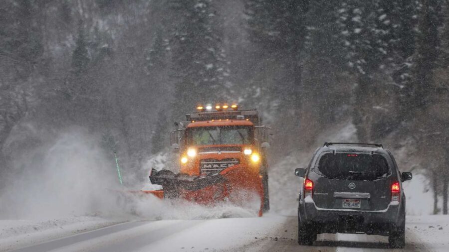
“Widespread winter driving conditions” are expected this weekend across most of the state, especially along mountain routes and roads by benches, the weather service notes. Traction restrictions are likely for some routes, like the Cottonwood canyons.
“Slow down and use caution while traveling,” the agency wrote.
All of the new snow may also elevate avalanche danger. Utah’s mountains remain in “moderate” danger as of Saturday morning; however, Utah Avalanche Center officials said Friday that “things are beginning to change and the avalanche danger is on the rise with more snow and wind expected.”
“It’s now necessary to develop a mindset of beginning to step back,” officials wrote in a report Friday.
The additional snow will be beneficial for Utah’s snowpack, which remains 70% of normal for this point in the water year, according to the Natural Resources Conservation Service.
Johnson said another storm is expected to impact Utah around the middle of next week.
Full seven-day forecasts for areas across Utah can be found online, at the KSL Weather Center.