Get Your Snow Shovels Ready: Morning Snowstorm Making Its Way Over N. Utah
Feb 5, 2021, 5:33 AM | Updated: 6:31 am
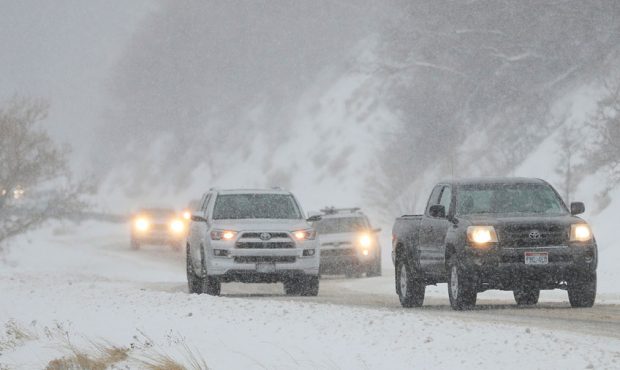
FILE: Motorists travel through the snow in Little Cottonwood Canyon on Tuesday, Feb. 5, 2019. (Jeffrey D. Allred, Deseret News)
(Jeffrey D. Allred, Deseret News)

SALT LAKE CITY, Utah – Cache County was the first area to be hit by the morning snowstorm Friday, and the storm will continue making its way south along the Wasatch Front.
This could mean issues for commuters who are hitting the roads later on in the day.
KSL meteorologist Grant Weyman said the storm could drop between 1 – 3 inches of snow in the valleys by Friday afternoon, and the mountains could see up to 10 inches.
Snow this morning! Through the afternoon- 1 to 3 inches valleys. pic.twitter.com/24m1h4E0gY
— Grant Weyman (@KSLweyman) February 5, 2021
The system is forecasted to make its way to Utah County by about 9 a.m., he said. It’s expected to taper off by the afternoon.
A road weather alert has been issued for most of the day Friday, and it includes I-15 north of Provo, 1-80 Tooele East, the entire route of I-84, and all canyon roads.
In Davis County, UDOT crews were called in about an hour early to prepare snowplows for the area’s roads. Officials are reminding drivers to move over and give space to those plows.
First batch of 🧂 salt 🧂 hitting the road… @UDOTRegionOne crews here in Clearfield in early to prep for the ❄️ storm 🥶. @KSL5TV tracking it this morning… pic.twitter.com/nKPNTogqKn
— Garna Mejia KSL (@GarnaMejiaKSL) February 5, 2021