Storms Improve Snowpack But Not Enough To End Drought
Feb 19, 2021, 7:16 PM | Updated: 8:06 pm

SALT LAKE CITY, Utah – Utah’s snowpack finally added more than just a few flakes over the past week and there’s more snow in the forecast.
And while the recent storm cycle gave the state’s water supply a significant surge, we’ll need a lot more to recover from the extreme drought that has gripped our state.
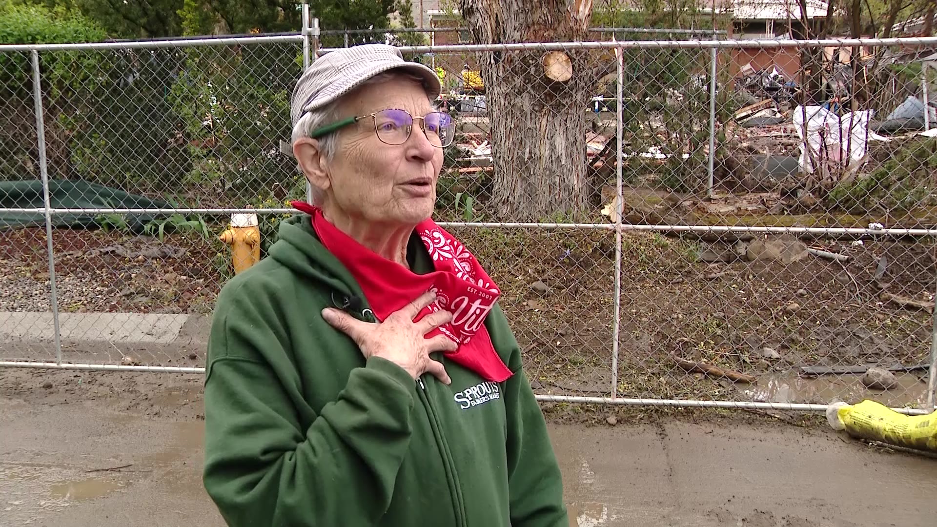
“Definitely, we’ve seen significant improvement since this storm cycle came through. But, there are some other areas that are still concerning,” said Jordan Clayton, SNOTEL snow survey supervisor with the Natural Resources Conservation Service.
Utah always needs big storms to replenish the water supply. Snowmelt that runs into reservoirs is the state’s primary source of water.
The storm two days ago was a big one with a lot of water in it.
“This was a big boost,” Clayton said. “It was a really big boost.“
It may seem like we got a whole winter-worth of snow over the last week, but @KSLweyman shows how the snow pack looks in terms of water. @jedboal is talking with officials about what this means for the snowpack, and water levels in the Spring/Summer. @KSLWeather pic.twitter.com/8SoPy66X20
— KSL 5 TV (@KSL5TV) February 19, 2021
A snowstorm finally piled a few feet of snow in the mountains but it was not a drought buster, especially in light of the dryness Utah has experienced over the last 11 months. Snowpacks statewide were in bad shape 10 days ago.
“The winter was looking pretty dire,” Clayton said. “We certainly hadn’t gotten snow that we wanted to get up until that point.”
Snowpack statewide was 50% to 60% of normal. That storm cycle, including record snowfall two days ago, raised the snowpack average to 80% — a boost of up to 20%.
“And, that’s not trivial. That’s a lot of water” Clayton said. “We gained around 2 1/2 inches, if you look at the state-wide average again, of snow water equivalent across the state.”
Utah is still about a half-foot short of average on snow water equivalent. Clayton said we would need 2 1/2 more storms like this one before early April to get us back to the average snowpack. The likelihood of that is 10 to 15%, based on their projections.
“It’s not likely at all,” he said. “It could happen. But, it’s not likely at all that we’re going to get to what we would consider normal snowpack.”
Even if those storms delivered the snow, soil moisture underneath the snowpack is poor. Unfortunately, some of that snow will get lost on the way to the reservoirs.
“We are seeing soil moisture levels that are off the charts bad. We really haven’t seen anything even close to this level of dryness going back the 15 to 20 years we’ve been making these observations,” Clayton said.
When the soil under the snow is that dry, spring runoff is less efficient because water from snowmelt seeps into the soil rather than the streams.
“That’s pretty alarming because that really suggests that we’re going to lose a larger percentage than we normally would of the water that comes out of that snowpack when it all melts,” Clayton said.
When the soil is saturated, more water flows into reservoirs which are now 65% of normal, down from 80% a year ago.
“From a water supply perspective, we don’t get the return on investment from that snowpack that we otherwise would have seen,” the hydrologist said.
If Utah has a cool, wet spring and summer, we will use less of that water from the reservoirs. But getting back to average water storage will take more than a few big storms.