Severe Thunderstorm & Flood Warnings Issued Across Utah
Aug 18, 2021, 12:37 PM | Updated: 12:46 pm
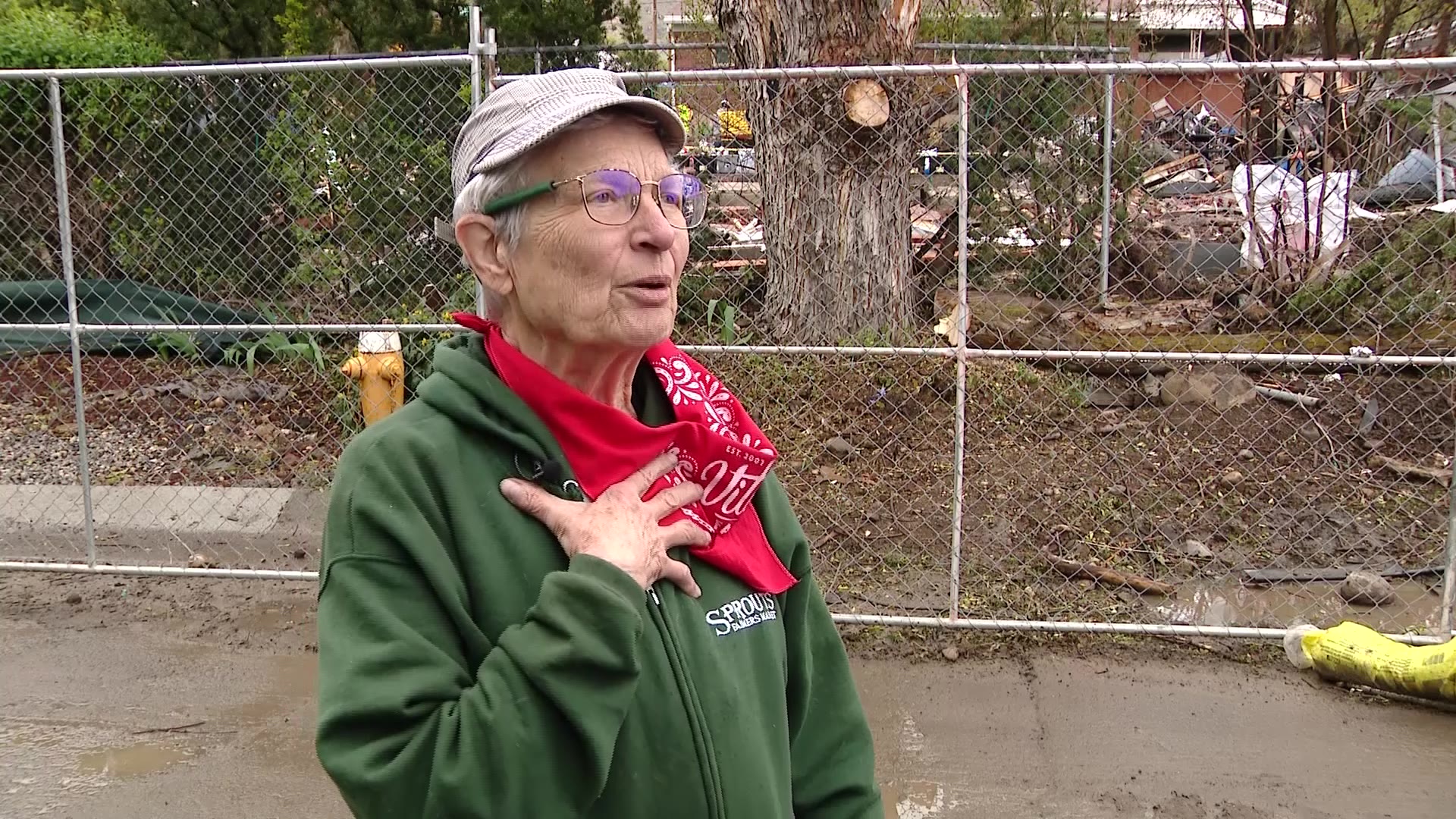
(Visit Cedar City/Facebook)
(Visit Cedar City/Facebook)
SALT LAKE CITY — Widespread rain and some strong to severe thunderstorms are expected to hit parts of the Wasatch Front, central Utah and portions of southern Utah on Wednesday.
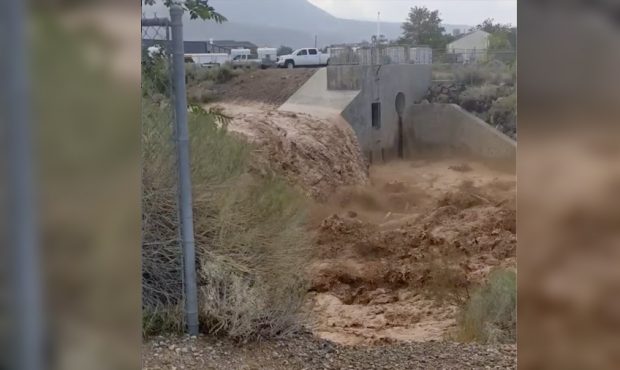
A flood warning, meaning flooding is imminent, was issued for southwestern Utah, including Cedar City and Zion National Park.
The warning remains in effect through 2 p.m. Wednesday.
Parts of Garfield and Wayne counties are under a flood warning through 3:15 p.m.
Here is some clarification on the difference between a flood watch and a flood warning. Keep up to date with @KSL5TV #utwx pic.twitter.com/ygIsFIsr7J
— Eric Morgan (@ericmorgan55) August 18, 2021
An Urban and Small Stream Flood Advisory has been issued for the Salt Lake Valley and portions of Tooele and Davis counties through 1:15 p.m.
Cedar City officials reported major flooding and debris along Airport Road, and they have asked the public to avoid the area.
Flash flooding, hail and strong gusty winds can be expected with some storms through late Wednesday. Meteorologists said snow is a possibility above 10,000 feet elevation for a short period Wednesday night.
Severe Thunderstorm Watch
Most of Utah will be under a severe thunderstorm watch through 8 p.m. Wednesday.
Showers and thunderstorms will continue through at least Thursday, maintaining some potential for locally heavy rain.
A severe thunderstorm watch has been issued for parts of Utah until 8 PM MDT pic.twitter.com/Swu3UAKlhW
— NWS Grand Junction (@NWSGJT) August 18, 2021