Another winter weather advisory issued for the Wasatch Mountains
Apr 21, 2023, 3:40 PM

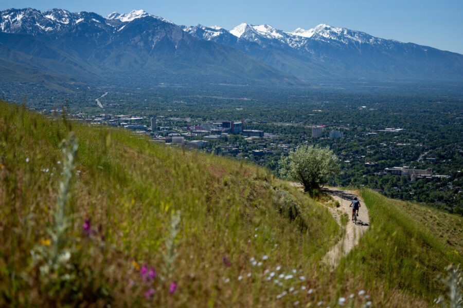
Salt Lake City and the Wasatch Mountains after a snowstorm in November, 2022 (Ray Boren)
(Ray Boren)

SALT LAKE CITY — The snow never stops, at least in northern Utah’s mountains.
Another winter weather advisory has been issued for the Wasatch Mountains, where up to another foot of snow or more is possible between Friday and Saturday, according to the National Weather Service. Most valley communities will receive rain, while some will end up with snow or a rain-snow mix at times Friday, adds KSL meteorologist Matt Johnson.
He said a high-pressure system southwest of the California coast is creating a pattern helping to move “small little systems” north of Utah to move into the Beehive State, resulting in more precipitation for the northern half of the state.
“That’s why we’re seeing, again, some cloud cover and a chance for showers,” he said.
While the weather service’s advisory takes effect at noon Friday, precipitation is expected to begin a bit earlier than that in mountain and valley areas. The system is forecast to “break up” as the day continues, resulting in some showers and light rain, at times, throughout the afternoon and early evening.
It’s expected to only bring about a tenth- to a quarter-inch of rain between the Wasatch Front and Cache Valley; however, snow accumulations of 6 to 12 inches are forecast for Wasatch and west Uinta mountains, according to the weather service. The advisory notes that up to 15 inches of snow are possible for the upper Cottonwood canyons by the time the advisory expires at 9 a.m. Saturday.
Snow to impact the northern mountains today through Saturday with the period of heaviest snow expected between 3PM and 9PM this evening. Upper Cottonwoods to see greatest impact, with Parleys, Logan, and Daniels summits also expected to see winter driving conditions. #utwx pic.twitter.com/F8cLn68y9n
— NWS Salt Lake City (@NWSSaltLakeCity) April 21, 2023
The weather service tweeted that from 3 p.m. to 9 p.m. Friday is when “the period of heaviest snow” is expected in the northern Utah mountains, adding that winter driving conditions are expected at the Daniels, Logan and Parleys summits in the region.
Johnson said the system is expected to clear up in the valleys by the end of Friday, leading to a warmup and more sun to start the weekend. High temperatures in the Wasatch Front will return to the mid-60s by Sunday before another small system arrives nearly next week.
The storm comes as Utah’s snowmelt continues, though the statewide figure has plateaued some because of the colder, wetter week in northern Utah. About 3.1 inches of water has melted from the statewide figure since it reached 30 inches on April 7, but only 0.1 inches of that has happened over the last three days, according to Natural Resources Conservation Service data, updated Friday morning.
Most of the melt has happened in southern Utah this week, which has been warmer and drier. For example, the southwestern Utah snowpack basin has lost 8½ inches of water since April 7, including 1½ inches over the past three days.
That’s expected to continue with next week’s forecast. Full seven-day forecasts for areas across Utah can be found online at the KSL Weather Center.