Strong weekend winds expected to bring snow to Utah’s mountains
Apr 5, 2024, 6:02 PM | Updated: 10:19 pm

SALT LAKE CITY — This weekend strong southerly winds are expected to blow in a spring cold front from California.
The National Weather Service of Salt Lake City issued a high wind warning in effect until 8 p.m. Saturday with gusty winds in the eastern valleys reaching upwards of 55 mph. These winds are expected to diminish after sunset, followed by some precipitation coming in from the West.
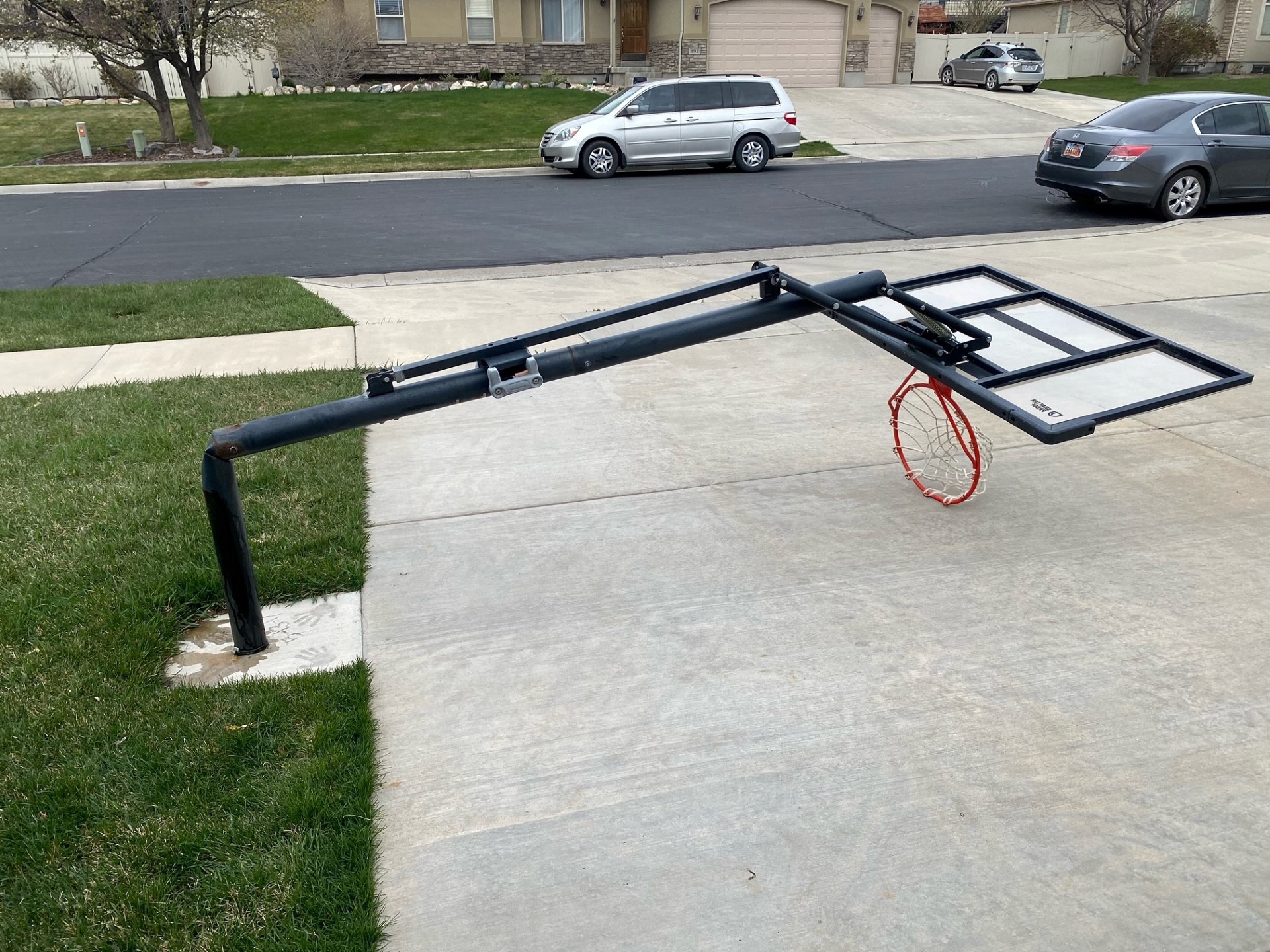
Some Utahns along the Wasatch Front and Saratoga Springs have already been experiencing these gusty winds. A temple worker at the Saratoga Springs Temple for The Church of Jesus Christ of Latter-Day Saints reported that the wind blew out a stained glass panel on the temple’s front door.
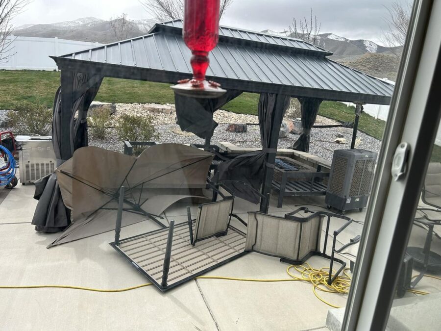
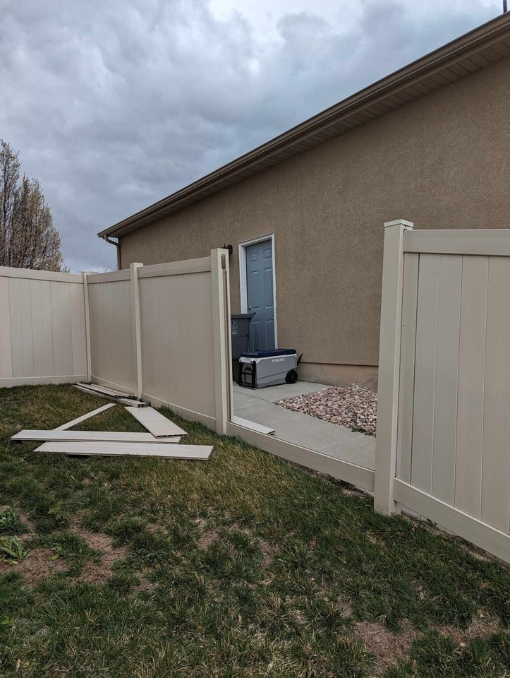
Valerie North, a Saratoga Springs resident, says that the winds that blew through around lunchtime left her backyard a wreck.
“It was the worst I’ve ever seen over here.” North said. “Garbage cans have been blowing around. I know people’s cars have been getting hit with shopping carts.”
Salt Lake City International Airport has reported small effects from the wind, with just five flights inbound to SLCIA diverted to other airports in the region.
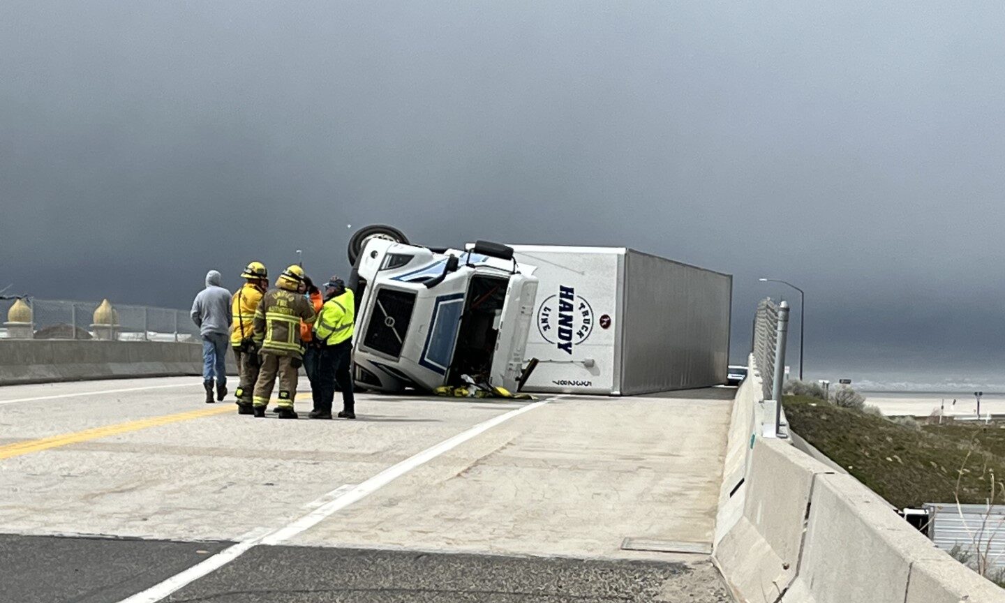
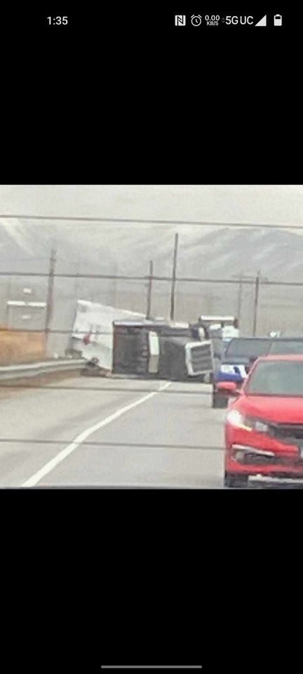
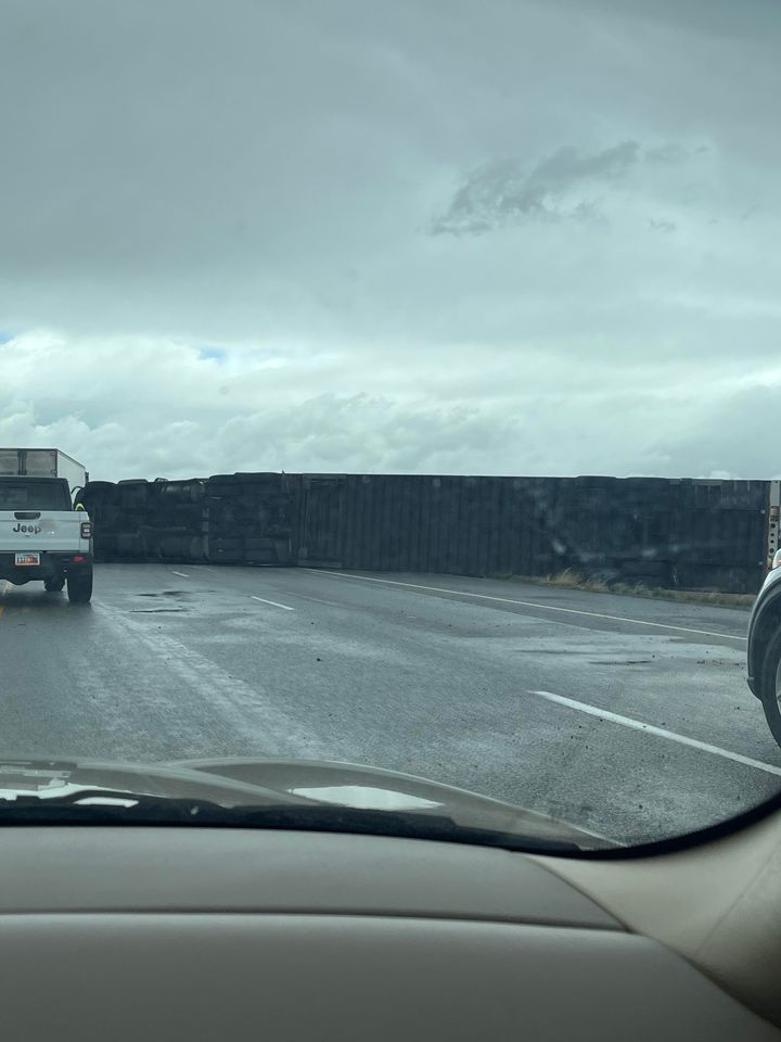
Utah Highway Patrol has reported three semis rolled over on Interstate 80 at miles 77 and 101, near Tooele County to the Utah-Nevada state line.
Tony Muir, a driver on I-80 this afternoon, reported seeing a big dust cloud on his route. Below the cloud, he saw a large semi truck tipped on it’s side.
“I wasn’t sure whether I needed to stop or keep going but I didn’t want to get hit either.” Muir said. “It broke my windshield in probably 20 places, all the rocks.”
Westbound I-80 is now closed to semis and trailers until further notice.
The National Weather Service recommends people stay indoors and avoid outdoor exercise due to wind-blown dust.
Some precipitation is expected following the wind, specifically in the eastern valleys according to the National Weather Service. Possible snowflakes may fall in the valley, with one to two feet of snow possible in the Wasatch Mountains.
UPDATE: Winds charge into Utah ahead of storm expected to bring snow to Utah’s mountains
Following the snow, the Utah Department of Traffic estimates that roads will run wet on most mountain routes, especially over Logan Summit along Highway 89, towards Powder Mountain, and in both Cottonwood Canyons.
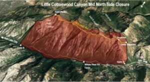
(Courtesy: UDOT) Map of Backcountry Closure, LCC Mid Canyon North Side, Gate B to Snowbird Entry 4. Closed 4/5 10pm to 4/6 5pm
Throughout the evening, cold air will move in, allowing snow to stick on roads at higher elevations. Snow showers are expected to continue throughout the weekend, with the heaviest fall estimated around noon Saturday. Northern and central mountains will be most effected.
According to UDOT, some roads will be less safe for travel and should be avoided whenever possible.
The following routes will experience weather-related travel concerns during the forecast period:
- I-80, Parleys Canyon to the Wyoming Border
- I-84, Through Weber Canyon to I-80 Jct.
- I-70, Clear Creek Summit; Salina Canyon/Summit
- U.S. 89, WY Border over Logan Summit; US-89/US-6 junction to Fairview
- U.S. 191, US-191 Summit; Indian Canyon Summit
- U.S. 40, Silver Creek Jct. to Fruitland
- U.S. 6, Spanish Fork Canyon over Soldier Summit to Colton
- S.R. 190 Big Cottonwood, Entire route
- S.R. 210 Little Cottonwood, Entire route
- S.R. 39, Entire route
- S.R. 248, Entire route
- S.R. 224, Entire route
- S.R. 16, Entire route
- S.R. 31, Entire route
- S.R. 153, Upper route
- S.R. 143, Upper route
Starting early next week, temperatures are expected to rise and stay steady throughout the remainder of the week.