Dangerous winter storm blasts Midwest with blizzard conditions and threatens Southeast with tornadoes and floods
Jan 9, 2024, 11:27 AM | Updated: 11:36 am
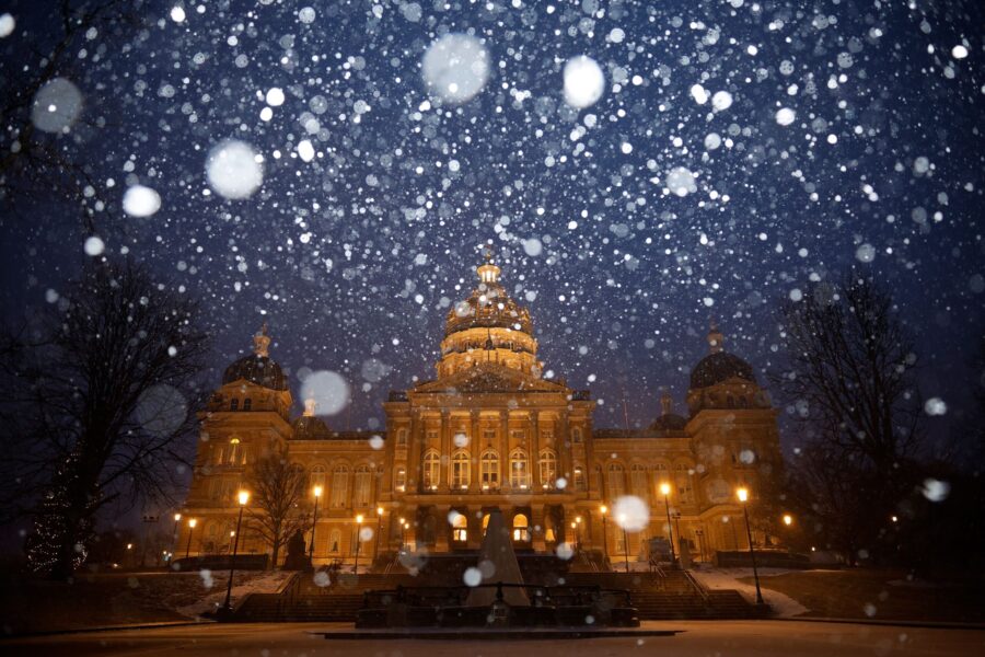
Snow falls on the Iowa State Capitol in Des Moines amid a powerful winter storm on January 8. (Chip Somodevilla, Getty Images)
(Chip Somodevilla, Getty Images)
(CNN) — A wide-reaching winter storm continues to pummel much of the eastern half of the country as it journeys from the Midwest up through the Northeast this week, knocking out power in several states and prompting the closure of highways, schools and government offices. Here’s the latest:
In the storm’s path? Bookmark KSLTV’s site for fast connectivity on low bandwidth.
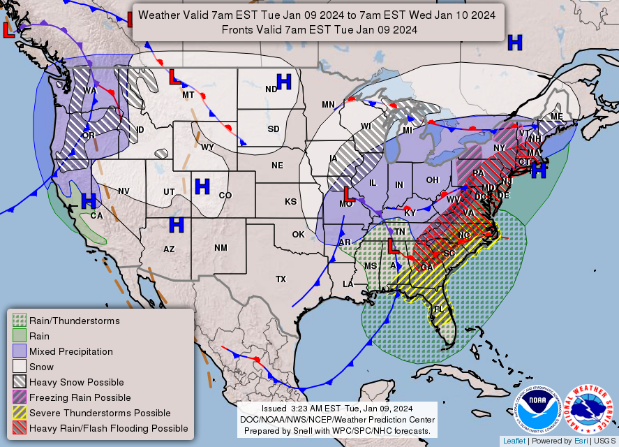
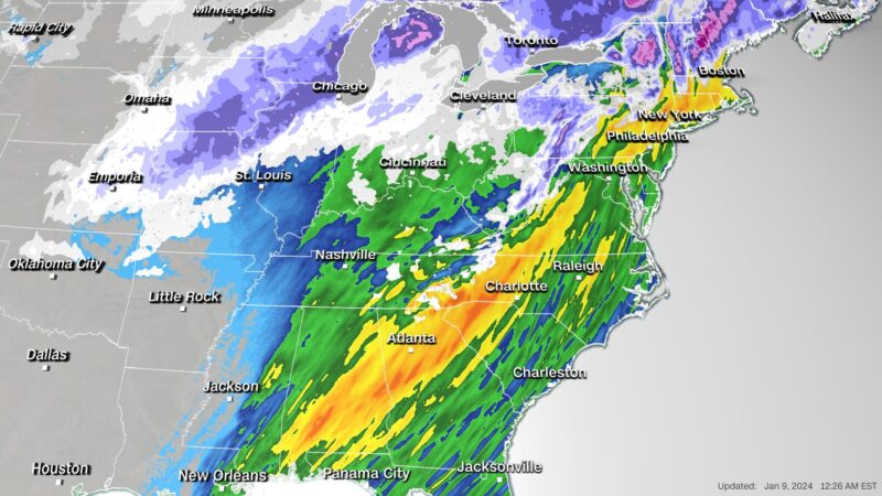
• More than 40 million people under severe storm threat: Weather alerts Tuesday stretch more than 2,000 miles from New Mexico to Maine, according to the Storm Prediction Center.
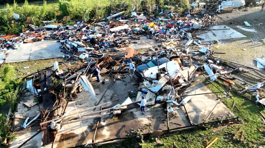
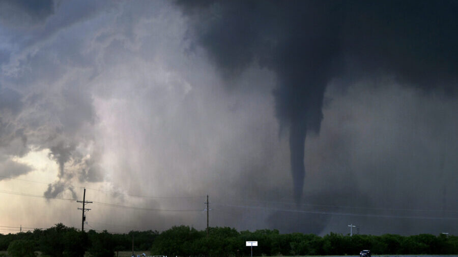
• Tornadoes threaten Southeast: Over 9 million people in Florida, Georgia, North and South Carolina are under a tornado watch issued by the Storm Prediction Center. Twelve tornadoes were reported across Florida, Alabama and Georgia on Tuesday morning, causing significant damage and prompting rescues in Florida’s panhandle.
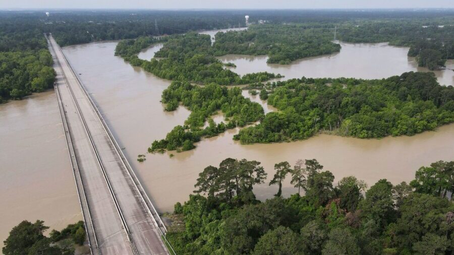
• Rain could trigger damaging flooding: Flooding is a significant concern in areas where heavy rainfall is soaking already saturated ground. Several major metropolitan areas along the East Coast could see flooding, including Atlanta, Washington, DC, and New York City, where rainfall of 2 to 4 inches is possible.
• Strong winds bring widespread power outages: With more than half the US population under wind alerts Tuesday, widespread power outages are underway. Nearly 400,000 homes and businesses across several states were already experiencing outages Tuesday morning, mainly in Alabama, Florida and Georgia, according to tracker poweroutage.us.
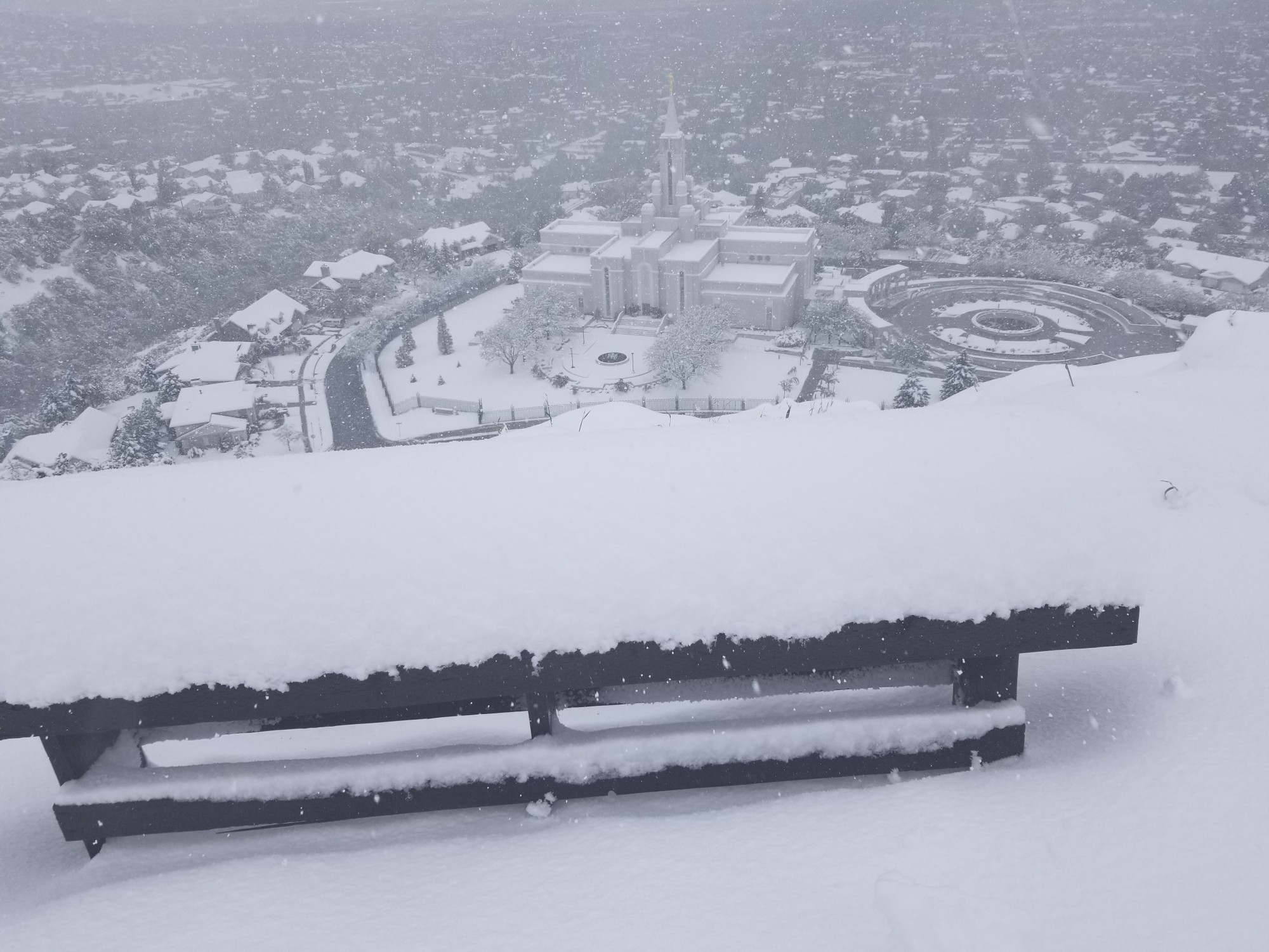
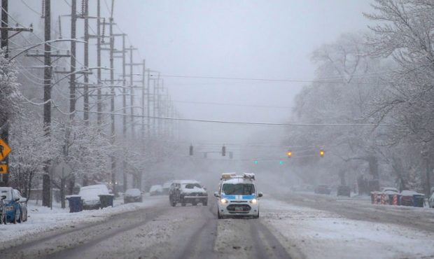
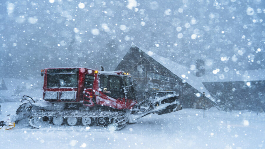
• Treacherous blizzard conditions shift east: Blizzard warnings spread from New Mexico to Nebraska through Tuesday morning as the threat shifts from the Plains to the Midwest. Another 2 to 6 inches of snowfall is possible in the area, along with winds of up to 70 mph.
• Up to a foot of snow possible from central US to Northeast: Winter storm alerts are in effect for areas of eastern Kansas, Nebraska and eastern Wisconsin, as well as interior parts of the Northeast and New England. Widespread snowfall between 6 to 12 inches is possible and some areas could see even more. The snowfall will begin to let up in the central US on Tuesday and in the Midwest, Great Lakes and Northeast on Wednesday.
Major cities in storm’s path brace for impact
Responders have rescued people from structures in Florida’s Bay County, where multiple tornadoes hit the ground and caused significant damage and road closures, Bay County Sheriff Tommy Ford said. Ford urged residents to seek shelter.
Florida Gov. Ron DeSantis declared a state of emergency Tuesday for 49 of the state’s 67 counties, citing the danger of tornadoes, strong winds, hail and flash flooding.
Despite numerous reports of damage from the severe storms in Florida’s panhandle, including 4 radar-confirmed tornadoes that hit the ground, no injuries had been reported so far, Kevin Guthrie, the state’s emergency management executive director, told CNN on Tuesday morning.
In the Northeast, Gov. Phil Murphy announced a state of emergency for New Jersey in preparation for the potentially dangerous weather. And Mayor André Sayegh of Paterson, New Jersey, declared a state of emergency for the city effective at 5 p.m. Tuesday in anticipation of a “torrential downpour.”
Paterson was hit hard by a coastal storm last month that trapped people in flooded vehicles and prompted overnight water rescues.
“We’ve learned lessons from a few weeks ago, and quite frankly, we want to assure residents that we are prioritizing their safety,” Sayegh said at a news conference Tuesday morning.
New York Gov. Kathy Hochul warned the storm could be “life threatening” and warned of the potentially dangerous combination of expected rainfall on top of the snow already blanketing the ground in the state, which saw up to 18 inches of snow in some areas. She said the Hudson Valley has a 70% chance of flash-flooding.
“We were able to handle this weekend’s snow event very well, but tomorrow’s storm is different and we’re taking it very seriously,” Hochul said Monday evening. The state is prepositioning more than 8,000 utility workers, four water rescue teams and dozens of massive generators, she said.
The coming storm has also prompted school and government office closures in several states on Tuesday, including North Carolina and Florida, where more than 30 K-12 school districts have canceled classes.
The system will dissipate by the week’s end, but relief is still not in sight for many across the eastern US. Another storm could follow on Friday and into the weekend, impacting many of the same areas.
Blizzard conditions trap travelers
Blizzard conditions buried parts of the southern Plains and central US under heavy snow and blistering winds on Monday, creating perilous road conditions that trapped drivers, forced several highway closures and at times made rescues near-impossible.
“Visibilities may drop below 1/4 mile due to falling and blowing snow. Whiteout conditions are expected and will make travel treacherous and potentially life-threatening,” the weather service warned Monday.
After Kansas Highway Patrol troopers responded to hundreds of calls for help on Monday, a spokesperson warned that increasingly severe conditions may prevent authorities from being able to rescue motorists.
“Please stay home,” the trooper said on social media. “We will not be able to rescue you if you get stuck because we are having trouble getting around.”
Parts of the Interstate 70 were also closed amid storm conditions and remained shut down overnight, the Kansas Department of Transportation said Monday evening.
Further west in New Mexico, 50 drivers were stranded amid blizzard conditions on Highway 56 in northeastern Union County and had to be dug out, the local sheriff’s office said Monday.
Flooding poses significant risks
Flooding is a serious concern as the storm’s strong winds blow water onshore as communities are inundated with rain.
“Widespread and potentially significant river and flash flooding are likely from the central Gulf Coast through much of the Eastern U.S. early this week,” the Weather Prediction Center said Monday. “Powerful onshore winds will lead to widespread coastal flooding along the eastern Gulf Coast and much of the East Coast.”
There’s also a significant concern of flooding in the Northeast with this next wave of rain coming right after the first snowstorm dropped more than half a foot of snow in multiple Northeast states.
New York City issued a travel advisory and flood watch that’s set to start Tuesday evening, warning of heavy rain, strong wind and the potential of coastal flooding.
“Let me be clear,” Hochul said in a Monday news briefing. “This will be an emergency, it will be serious and we’re urging all New Yorkers to exercise extreme caution at this time.”
Heavy rain will accelerate snowmelt and increase the amount of water running off into waterways, raising the ceiling on the flood potential in these areas.
CNN’s Lauren Mascarenhas, Nicki Brown, Dave Hennen, Mary Gilbert, Taylor Ward, Jennifer Feldman, Maria Sole Campinoti, Jennifer Henderson and Amanda Jackson contributed to this report.