Caution: Strong weather takes Utah into the weekend
Aug 5, 2022, 12:33 PM | Updated: 1:31 pm
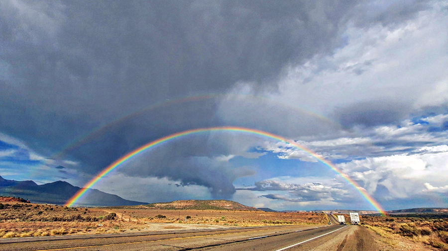
A double rainbow captured between Monticello and Moab Utah. (Courtesy Kaylee Dalton)
(Courtesy Kaylee Dalton)

SALT LAKE CITY — Utah heads into the weekend with some potentially wild — and even dangerous — weather on the horizon.
The National Weather Service’s Salt Lake City office warns of potential flooding in many of the state’s recreation areas Friday and Saturday with some strong thunderstorms in northern Utah expected Friday night.
Southern Utah flash flood potential
NWS states an increased risk of flash flooding for southern Utah national parks and recreation areas. It advises anyone using the recreation areas to check in with local visitor centers or ranger stations before heading into the outdoors and to have a plan to get to safety if threatening weather approaches.
Drivers are routinely cautioned against trying to drive through flooding and are urged to turn around if they encounter flash flooding across a roadway. The government service provided a chart for the two days showing Zion National Park and San Rafael Swell as the locations with the highest probability of flooding on Friday but with some possible flooding nearly everywhere people spend time outdoors over the weekend.
In those two locations some slot canyons, dry washes and small streams are expected to experience flash flooding. Seven hikers were killed in Zion in 2015.

Flash flood conditions for Aug. 5-6 2022. (NWS)
Glen Canyon Recreation area and Canyonlands National Park have no expected flash flooding, though weather is always unpredictable.
Flash flood risk: Northern and central Utah
Showers and thunderstorms are expected to develop across northern and central Utah Friday afternoon and evening. According to NWS they will be capable of heavy rainfall and could cause flash flooding in areas near recent burn scars, near steep terrain and normally dry washes.
It cautions hikers and other enjoying outdoor recreation to be prepared for both lightning and fast moving water.
“Turn around, don’t drown,” NWS stated. “Do not drive through flooded and impassable roads and other low lying areas.”
The weather risk is listed as “moderate” or a 3 on a 5 level scale. The area included in the warning includes parts of Salt Lake County and north for much of the central and western portion of the state.
Northern Utah thunderstorms
A few thunderstorms, mainly in northern Utah will be capable of strong, gusty winds and small hail in parts of northern Utah, along with the potentially heavy rainfall.
The potential for the thunderstorms include Salt Lake City, Tooele, Wendover, Brigham City, Ogden and the region west of those cities.
NWS advises residents to secure loose outdoor items including trash cans or trampolines.
“Be prepared for lightning. If you can hear thunder, find shelter,” NWS said. Much of the state will have rain or with the strongest expected in northern Utah.
Send video and photos of your remarkable weather, along with your breaking news to Social@KSL.com.